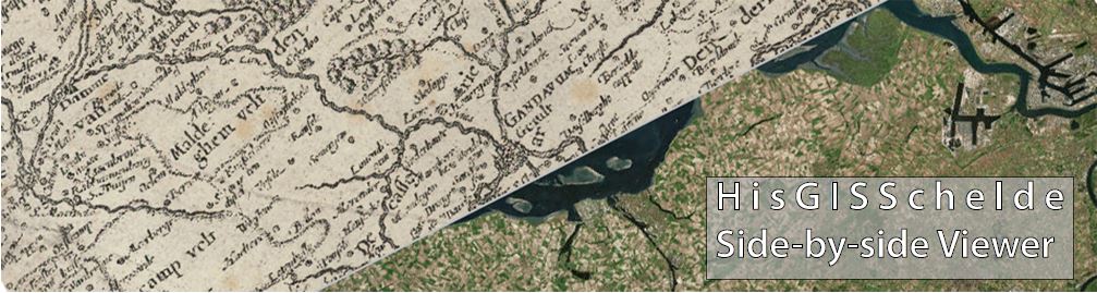
About HisGISSchelde
Throughout its rich history, the surroundings of the 360 km long Scheldt river have always been a very dynamic area and topographically determining for an area with both natural (storm surges and inundations) and anthropogenic (reclamation, economic activities, war, habitation, etc.) influences.Historical maps are the ideal medium to gain some insights into the dynamics of the Scheldt area. Those documents are often able to freeze the historical condition of the area at a specific time, capturing it as a silent witness. Moreover, Flanders -and by extension the Netherlands- was among the absolute world leaders in cartography from the 16th century onwards. This led to the availability of detailed maps of Flanders -including the Scheldt area- at a very early stage. This webpage makes the historical maps of the Scheldt, the Western Scheldt and its adjacent areas available digitally. One can visualize the maps utilizing the application underneath and compare them simultaneously with contemporary topographical maps. All historical sources are georeferenced in a standardized way in order to compare them. In line with the open data movement, the relevant metadata is offered freely to end-users.
![]()
![]()
![]()
![]()

Please wait this can take a couple of seconds.